Navajo Nation
Navajo Nation
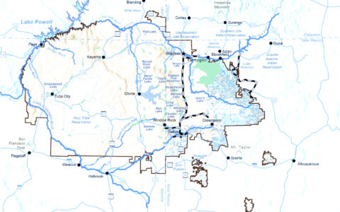
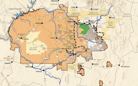
The Navajo Indian Reservation was established in 1868 and has been expanded through a series of executive orders, public land orders, and acts of Congress to become the largest Indian reservation in the United States covering more than 27,000 square miles (roughly the same size as West Virginia) in the Four Corners Region in Arizona, New Mexico and Utah. The tribe’s official name is the Navajo Nation.
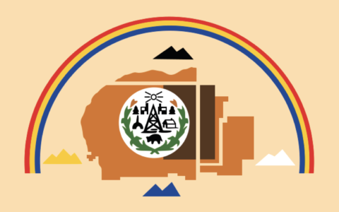
The Navajo ancestral lands are located within and near the four sacred Mountains of Blanca Peak in Colorado, Mt. Taylor in New Mexico, San Francisco Peaks in Arizona, and Hesperus Peak in Colorado as illustrated in the Navajo Nation flag. Almost all the Navajo Nation is located within the high desert of the Colorado Plateau physiographic province. The complex topography of Navajo Nation is characterized by arid deserts at elevations as low as 5,500 feet and elevations as high as 10,500 feet. The following are taken from portions of Chapter 5.5 – Navajo Nation of the Colorado River Basin – Ten Tribes Partnership Tribal Water Study (2018).
Historical Use and Access to Water
The Navajo Nation’s historical use of water is extensive. The largest uses of water are for irrigation, industrial, municipal and domestic purposes. Lesser amounts are used for livestock and other purposes. Navajo Nation lands are within the Upper Colorado River Basin, Lower Colorado River Basin, and the Rio Grande Basin. The Navajo Nation has extensive water rights which are largely unquantified except in the San Juan River Basin of New Mexico.
The Navajo Nation has access to on-Reservation surface water, the amount of surface water available for use depends on location, drainage area, precipitation and quality. Surface water sources for the main Reservation include the mainstem of the Colorado River, the Little Colorado River, the San Juan River, and ephemeral streams and washes. The major surface water supplies are described below.
Groundwater is the most heavily utilized and dependable municipal water source for the Navajo Nation. It is found in the major water-bearing formations described below, as well as other minor aquifers. Although groundwater storage greatly exceeds the annual demand, only a small fraction of the groundwater in storage can be readily developed. It is also important that domestic groundwater withdrawals in the future remain within sustainable limits to ensure an adequate supply of water for future generations of Navajo people.
Environmental, Cultural, and Recreational Water Use
The reservoirs on the Navajo Nation provide storage for irrigation water, livestock, wildlife and recreation. There are more than 20 significant storage facilities, a reservoir was considered significant if it has a surface area greater than 200 acres, is included in the NDWR Safety of Dams Plan of Operation, or is stocked by the Navajo Department of Fish & Wildlife. The lakes and reservoirs have a combined storage capacity greater than 80,000 AF.
The Navajo Nation has been waging an uphill battle for many years to maintain and modernize its water resource infrastructure. However, given existing agency resources, budgets, and authorizations, many of the water infrastructure deficiencies on the Reservation will continue to go unattended and the problems may become more acute.